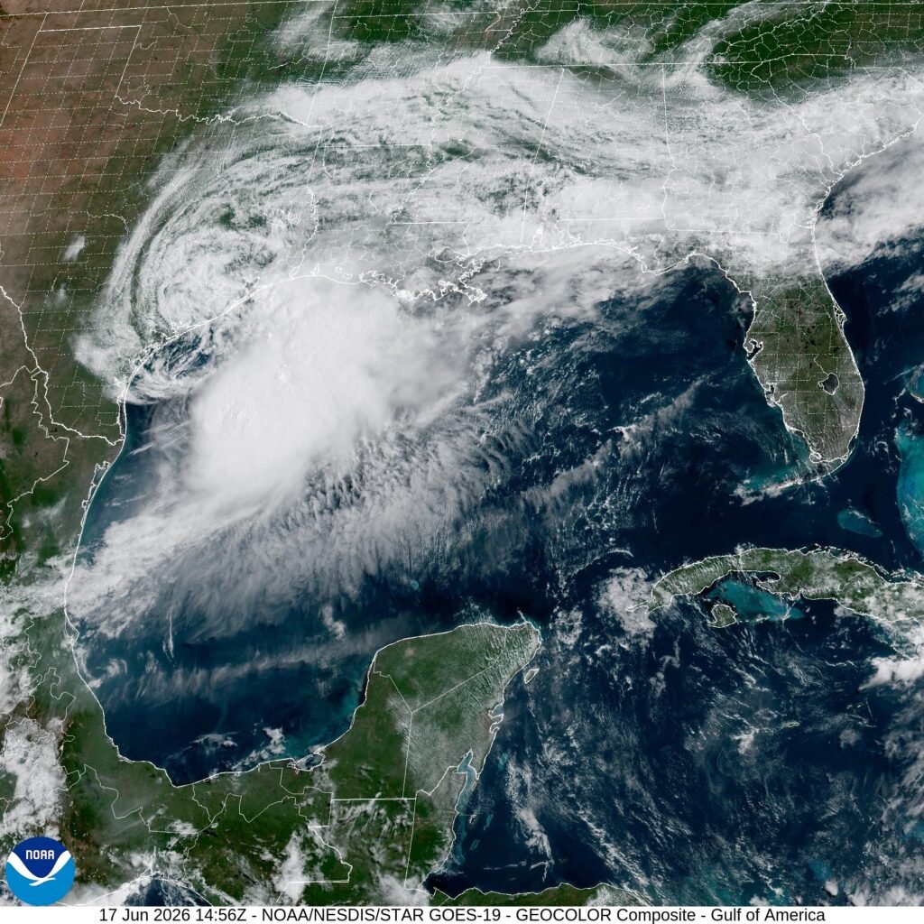
Tropical Storm Arthur has formed — the first named storm of the 2026 Atlantic hurricane season — and forecasters are warning it could bring life-threatening flash floods to the northern Gulf Coast.
Arthur isn’t expected to strengthen further, according to NPR’s report Tuesday, June 17. That’s the relatively contained part of the picture. The flood risk, though, is the piece forecasters are flagging hardest, and flash flooding along low-lying coastal corridors can kill quickly even without a storm ramping into hurricane status.
No storm. Still dangerous. That’s the dynamic forecasters are describing.
The Gulf Coast has seen repeated episodes of rainfall-driven flooding in recent years that caused casualties and property damage well before any associated system reached hurricane strength. Tropical storms — even weakening or stalled ones — can dump enormous amounts of water in a short window, particularly over areas where soil saturation or urban drainage is already strained.
Arthur is the opening entry in what meteorologists designate each June 1 as the official Atlantic hurricane season, which runs through November 30. Named storms are assigned in alphabetical order as they meet the threshold of sustained tropical-storm-force winds — 39 mph or higher. Arthur cleared that mark first this season.
Forecasters have not released a detailed track showing exactly which portions of the northern Gulf Coast face the highest flash flood exposure, beyond the broad regional warning NPR cited. The precise timing of any rainfall impact hadn’t been specified in early reports.
Whether Arthur ultimately makes any kind of landfall — or dissipates over open water — wasn’t addressed in the initial forecast summary NPR reported Tuesday, June 17, 2026.
Reported by NPR. Read the original report.